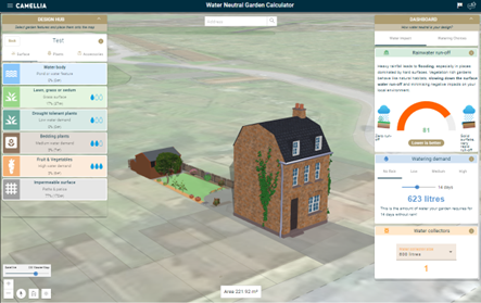
Water Neutral Garden Calculator
Provide an educational design tool for gardeners and community groups. Spread knowledge about improved water management and the impact garden design can have on the wider water network.
Svea Rautenberg (BGS)
Author
Contact Svea Rautenberg
Email
Project website
mapapps.bgs.ac.uk/water-neutral-garden-calculator/ ❐
Related resources from The Royal Horticultural Society
The RHS also have some excellent information and guidance about managing water in your garden, which can be found on their Managing water in your garden web page. On this page there is also a link to the Mains 2 Rains pledge page, where you can pledge to manage the water in your garden in a more efficient and environmentally beneficial way.
Details
Gamifying Sustainability: Exploring Water Management through Water Neutral Garden Calculator's Gamified User Experience
Community-driven sustainability
The Water Neutral Garden Calculator (WNGC) project was driven by a vision to create a sustainable and ecologically beneficial green space for the residents of a South London housing estate.
The tool has developed from the single-site use case prepared for the Kipling Community Garden Project.
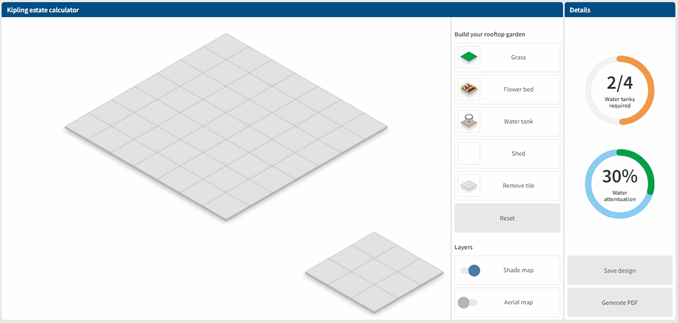
The community group at the estate were interested in how to make best use of their roof space, with the key driver being: reduced water usage. Knowing about approximate watering, needs and required storage volumes allowed them to appropriately plan the communities time commitment.
Over time the tool evolved into a versatile application that could be adapted to different urban environments, helping users create water-neutral green spaces, regardless of their location. This benefits the community by providing urban green spaces that can be enjoyed by residents and assist the water companies and local government authorities by reducing run-off, and consequently stress on the urban sewer and water management networks, exacerbated by climate change and more frequent extreme weather events.
Who is it for?
By provisioning novel designs of gardens and urban greenspaces, this educational tool, enables collaboration between disconnected communities, benefiting gardeners, schools, industry, local government, and urban planners by promoting water conservation and aiding in grounding sustainable ideas in the public space.

In addition to engaging with local community groups, the project brought together academics and researchers in the fields of hydrology (Imperial College London), urban planning (UCL), landscape architecture, environmental and geospatial science (BGS) with an emphasis on co-design with stakeholders and end-user community groups. This cross-disciplinary collaboration enriched the design process, ensuring that the water neutral garden calculator was both scientifically sound and community-driven.
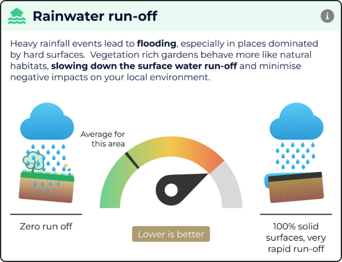
The WNGC is an educational garden design tool highlighting the importance of water conservation and limiting surface water runoff in a modern world where water management concerns have grown.
Gamified user experience
Making use of the ArcGIS Maps SDK for JavaScript and specifically the SketchViewModel feature of the API, and leveraging WebStyleSymbols in a 3D SceneView, the WNGC gives the user an exciting and more realistic representation of their garden environment and contributes to a gamified user experience, whilst teaching them about water management based on current scientific research.
The tool provides the ability to draw different surfaces on the map via the SketchViewModel functionality provided by the API. These areas represent different watering demand planting areas, for example, low, medium and high watering demand plants and impermeable surfaces. The area of each type of surface is recorded and used to provide the calculations that are visualised in the dashboard area.
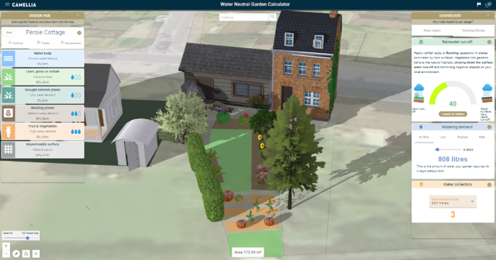
The ArcGIS Maps SDK for JavaScript was particularly useful to allow capture and local web browser storage of all the assets used in each design by allowing the class objects to be converted to JSON for storage and then to be converted back again. The application also utilises the geometryEngine to detect when surfaces overlap and display an appropriate message when this event occurs.
The daylight widget provides accurate sunlight display for any time of the day throughout the year, thus helping decision making based on shade and sunlight.
Considering shade coverage of the garden space, adjusting the height of buildings, accessories and large plants can help garden design choices, depending on the planting type suitable for a shaded environment.
How was it developed?
The application was developed using the Angular web framework utilising ESRI's @arcgis/core package to build a modern responsive web application for the desktop environment. It is specifically focussed on the Greater London area and uses the Ordnance Survey (OS) MasterMap™ vector basemap product to show detailed building footprints and outlines. This assists in locating a specific house or building to start the garden design process. Whilst the focus was initially on the Greater London area, the application can be used to design gardens at any location on the planet, as there are no restrictions to limit this, however the use of OS MasterMap™ is confined to the United Kingdom.
Overall, the tools provided by ArcGIS Maps SDK for JavaScript made the development of the WNGC simpler by providing out-of-the-box solutions to enable faster development.
Impact on surface water sewers
In central London where a combined sewer system is in place that carries both foul water and surface water to treatment facilities the load on the system is particularly strong and any improvements individuals and businesses can make to reduce surface water runoff will contribute to a more resilient infrastructure that can cope with climate induced more frequent storm events.
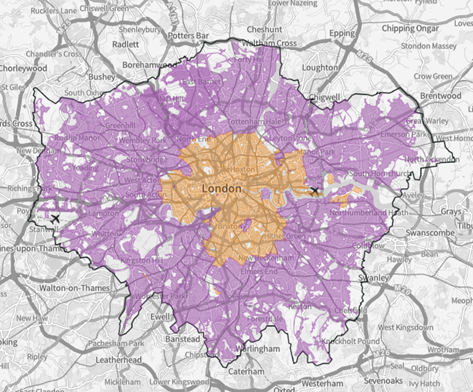
Figure 1: London Sewer network, orange denotes Combined Sewers and Purple Separate Sewer networks for Foul and Surface water (Source: River Health Map London (https://apps.london.gov.uk/river-health/)
An educational tool for everyone
We envisage this tool to be used by individual gardeners looking to improve their gardens ecological footprint, community groups with a desire to regreen their urban environment and as an educational tool in schools to teach children about water conservation. The tool could also be used by urban planning authorities to inform in their design of new residential projects with view to improving water management by limiting the run-off into the local sewer system.
Sparked by discussions with the Silk Stream project group, the tool has undergone further development to encompass other element such as roof infrastructure into the rainwater run-off calculations.
The inclusion of roof types, including green roofs and roofs disconnected from the mains surface water drains allows users to not only see the impact of their garden design but also other infrastructure changes they might consider for their property.
Related links
Water Neutral Garden Calculator ❐
Kipling Community Garden Project ❐