Resources
Access to data, models and resources to help inform your decisions

Meeting future challenges
Cities of the future will be more populated and affected by climate change, exacerbating challenges. As a result, the water environment will require better management.
Through our work, we have developed a range of tools and techniques to meet these challenges.
Data

Search our data catalogue
Explore our data using advanced search and filtering methods on the metadata catalogue
Geonetwork metadata catalogue ❐
Water Data Explorer
Explore data about London's water environment using spatial visualisation maps and interactive applications
Access the Water Data Explorer ❐
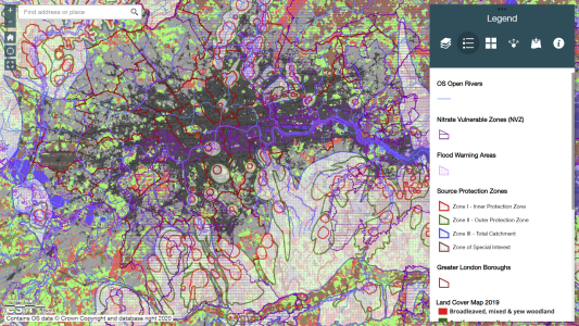
Spatial Data Explorer
Visualise all of the water-related data at once or interrogate and add your own data using our online web GIS. This application is recommended for users with experience in geographical information systems (GIS) or with online map viewers.
Access the Spatial Data Explorer ❐
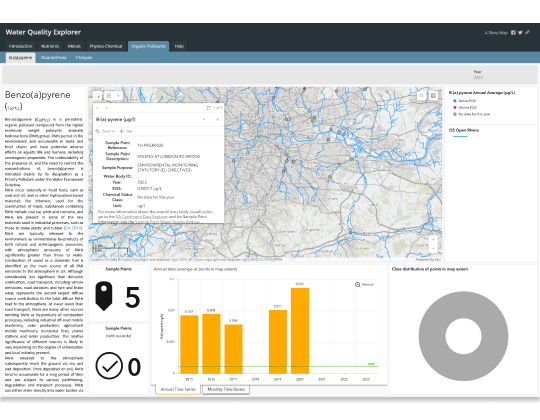
Water Quality Dashboard
The Water Quality Dashboard presents data about river water quality and how it varies, both geographically and in time. Data for various water quality indicators is displayed on interactive maps within the dashboard, which can be filtered by year.
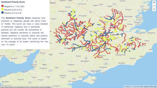
River Sentiment Dashboard
The River Sentiment Dashboard supports river stewards with live information about social media sentiment regarding 400 water bodies in the Thames basin. The tool answers the question how Twitter users feel about a specific water body.
Methods

Community modelling
Community modelling gives local people an opportunity to make use of scientific computer modelling.
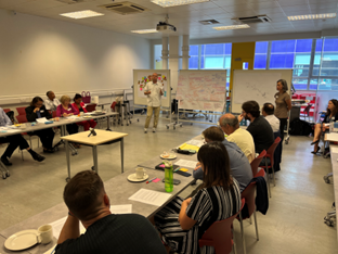
Wealdstone Brook Workshops
Wealdstone Brook Workshops is a method for collaborative exploration of hard-to-solve local water management problems. It is applicable in situations of unclear responsibilities and deficient communication among stakeholders. The method includes techniques for identifying stakeholders and bringing them together in exercises that clarify challenges and generate novel solutions.
Tools
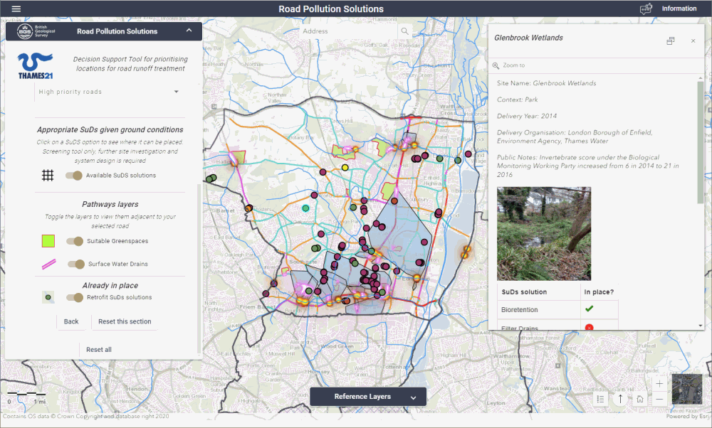
Road Pollution Solutions Tool
The Road Pollution Solutions Tool helps identify the sections of roads that are likely to contribute the most pollution to our rivers and to explore where sustainable drainage scheme could be placed to reduce this.
Road Pollution Solutions Tool ➝
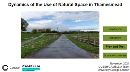
Use of Urban Natural Space (system dynamics model)
A System Dynamics (SD) model aimed at collectively designing strategies for improving people’s Use of Urban Natural Space (UoS) in Thamesmead (London, United Kingdom).
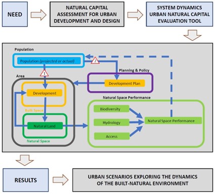
Natural Space Performance (system dynamics model)
A System Dynamics (SD) model aimed at identifying appropriate urban design and management strategies, while developing sustainable approaches to urban planning in Thamesmead (London, United Kingdom).
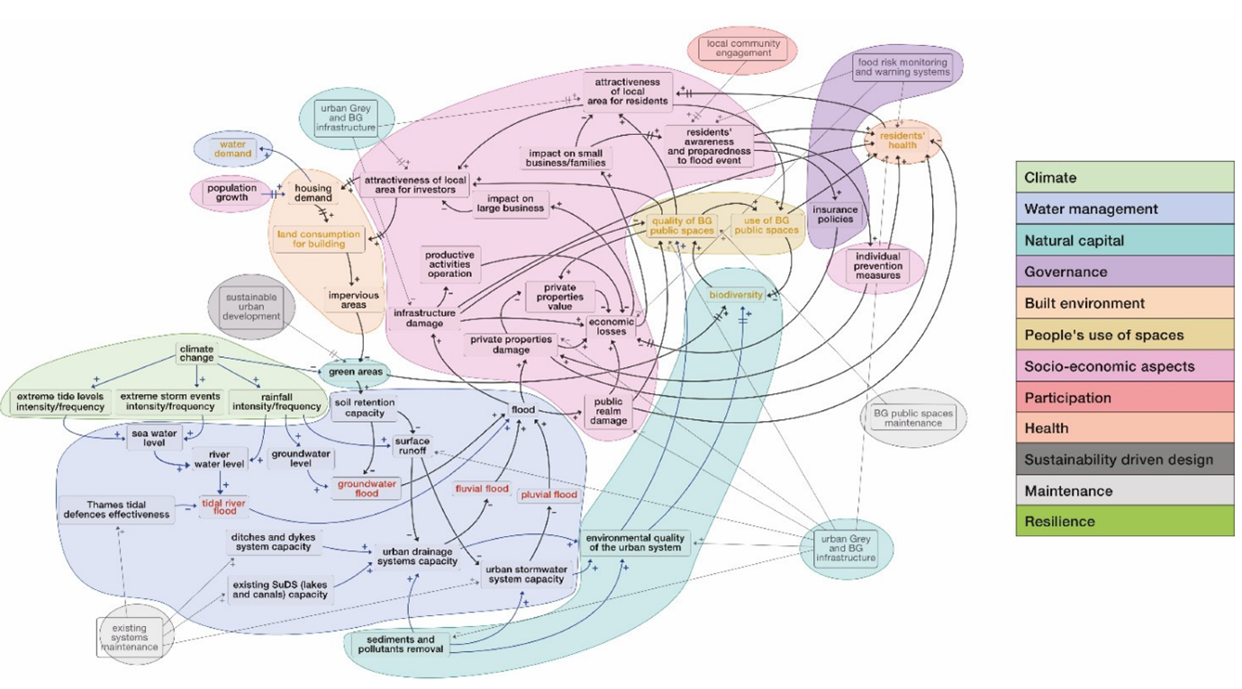
Urban Flood Resilience (system dynamics model)
A flood risk System Dynamics (SD) model aiming at supporting decision-makers in enhancing urban flood resilience in Thamesmead (London, United Kingdom).
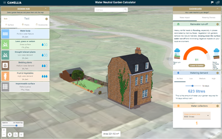
Water Neutral Garden Calculator
Provide an educational design tool for gardeners and community groups. Spread knowledge about improved water management and the impact garden design can have on the wider water network.
Water Neutral Garden Calculator ➝
Water Futures
A website for exploring how changes in climate and other environmental conditions affect the way water is supplied to your home, school and places of work using a model (WATHNET) developed at the University of Oxford.
Explore the Water Futures website ❐
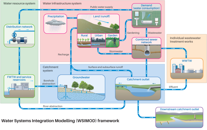
WSIMOD
(Water Systems Integrated Modelling)
WSIMOD is a Python modelling framework that integrates the movement of water as affected by physical and human processes.
WSIMOD ➝
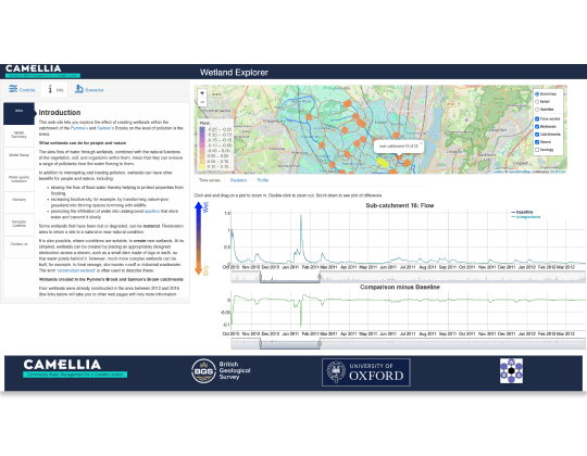
Wetland Explorer
Explore how wetlands can improve the health of a river. The Wetland Explorer lets you investigate how the creation of new wetlands within a catchment could affect the level of pollution in its rivers.
Research and education

Water management lesson plans
Educational resources to help students understand the complexities of providing clean and safe drinking water.
Publications

Publications
Water Info Hub publications library will come later. Here are other publications related to water management in London.
Water management publications ❐